Astronomy Picture of the Day
Discover the cosmos! Each day a different image or photograph of our fascinating universe is featured, along with a brief explanation written by a professional astronomer.
2011 November 18
Discover the cosmos! Each day a different image or photograph of our fascinating universe is featured, along with a brief explanation written by a professional astronomer.
2011 November 18
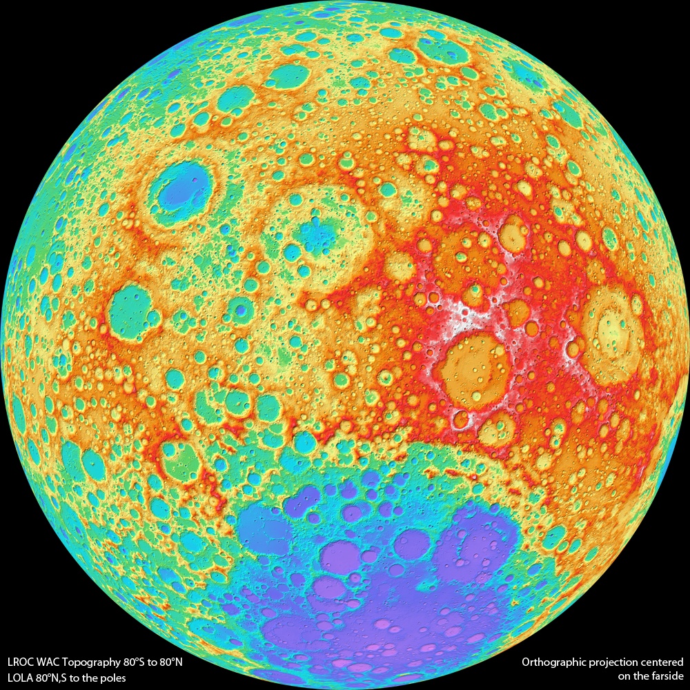
Explanation: This colorful topographical map of the Moon is centered on the lunar farside, the side not seen from planet Earth. That view is available to the Lunar Reconnaissance Orbiter though, as the spacecraft's wide angle camera images almost the entire lunar surface every month. Stereo overlap of the imaging has allowed the computation of topographical maps with coverage between 80 degrees north and south latitude. The results have about a 300 meter resolution on the lunar surface and 10 to 20 meter elevation accuracy. Data closer to the north and south poles is filled in using the orbiter's laser altimeter. In this map, white, red, green, and purple represent progressively lower elevations. In fact, the large circular splotch tending to purple hues at the bottom is the farside's South Pole-Aitken Basin. About 2500 kilometers in diameter and over 12 kilometers deep, it is one of the largest impact basins in the Solar System.
Authors & editors:
Robert Nemiroff
(MTU) &
Jerry Bonnell (UMCP)
NASA Official: Phillip Newman
Specific rights apply.
NASA Web
Privacy Policy and Important Notices
A service of:
ASD at
NASA /
GSFC
& Michigan Tech. U.